Posts

Bangladesh Tranverse Mercetor (BTM)

Image
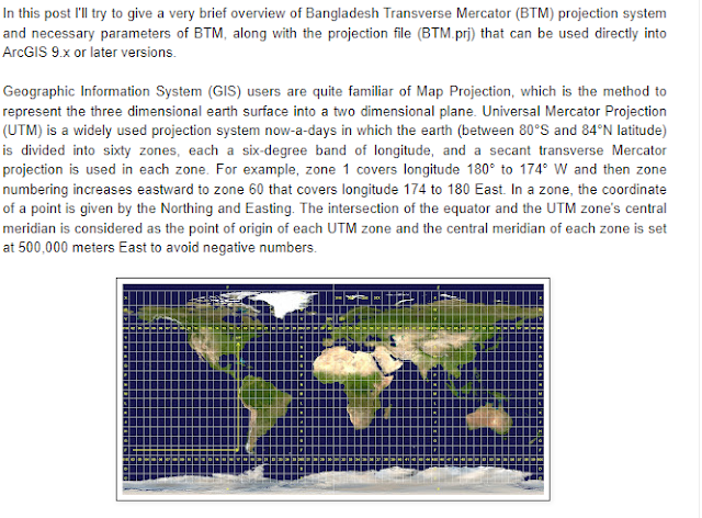
Bangladesh Transverse Mercator (BTM) A projected coordinate system has a flat, 2D surface with constant lengths, angles, and areas across the two dimensions. Which makes it easier to calculate properties  like area, distance of a object in map. UTM (Universal Transverse Mercator) is a widely used projected coordinate system which divides the Earth into sixty zones, each in six-degree interval. As Bangladesh lies between UTM Zone 45N and 46N, FAP19 has adopted a Transverse Mercator projection for Bangladesh. Parameter of this projection are NAME BANGLADESH TRANSVERSE MERCATOR (BTM) Projection Transverse_Mercator False_Easting 500000 False_Northing -2000000 Central_Meridian 90 Scale_Factor 0.9996 Latitude_Of_Origin 0 Linear Unit Meter (1.0) Geographic Coordinate System GCS_Everest_1830 Angular Unit Degree (0.0174532925199433) Prime Meridian Greenwich (0.0) Datum D_Everest_1830 Spheroid Everest_1830 Semimajor Axis 6377299.36 Semiminor Axis 6356098.352 Inverse Flattening 300.8017 Please no

ESRI ARCGIS Download version 10.8.1

Image
  ArcGIS 10.8.1

SPSS 26 Full downlaod iso file

Image
Click the following link  SPSS

Google Earth Pro download full

Image
Google Earth pro pro provides sattelite imagery. click the following link to download it. Google Earth Pro  https://1drv.ms/u/s!AjlTfEQ58j61gQFGR2d4ERpYEp8f?e=1Jlq8h

Concept of Location in Geography

Image
A particular place or position. "the property is set in a convenient location" In geography, location or place are used to denote a region (point, line, or area) on Earth’s surface or elsewhere. The term location generally implies a higher degree of certainty than place, the latter often indicating an entity with an ambiguous boundary, relying mor  on human or social attributes of place identity and sense of place than on geometry. location is the place where a particular point or object exists. Location is an important term in geography, and is usually considered more precise than "place." A locality is a human settlement: city, town, village, or even archaeological site. A place's absolute location is its exact place on Earth, often given in terms of latitude and longitude. For example, the Empire State Building is located at 40.7 degrees north (latitude), 74 degrees west (longitude). It sits at the intersection of 33rd Street and Fifth Avenue in New York City

Remote Sensing Software Download / ERDAS EMAGINE

  ERDAS EMAGINE with Crack

Definition of Human Geography / What Is ‘Human Geography’?

Image
Definition of Human Geography The study of the patterns and dynamics of human activity on the landscape. Broadly conceived, human geography includes both those areas of geographic study that are more narrowly focused on human activity, and those that are particularly concerned with human-environment dynamics, or the nature–society tradition (W. Moseley et al., 2007) ‘That part of the discipline of geography concerned with the spatial differentiation and organization of human activity and its interrelationships with the physical environment’ (R. J. Johnston et al., 2000). Human geography is concerned with the distribution and networks of people and cultures on Earth’s surface.  A human geographer might investigate the local, regional, and global impact of rising economic powers China and India, which represent 37 percent of the world’s people. They also might look at how consumers in China and India adjust to new technology and markets, and how markets respond to such a huge consumer ba