Posts

Showing posts with the label GIS Mapping

How to Prepare Campus Map or Any Institutional Location Map using ArcGIS and with a little help of Graphics
Image
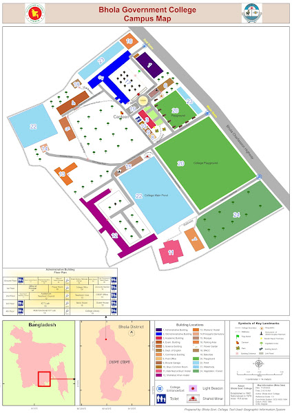
Locator map using ArcMap Creating a campus map or institutional location map using ArcGIS, coupled with graphic design elements, can significantly enhance the overall navigational experience for users. ArcGIS, a powerful geographic information system (GIS) software, allows for the integration of spatial data, making it an ideal tool for mapping diverse campus features. Begin the process by gathering relevant spatial data, such as building outlines, walkways, parking lots, and landmarks. This information can be collected through satellite imagery or surveyed using GPS devices. Import the data into ArcGIS, ensuring accurate georeferencing for precise spatial representation. Utilize the software's layering capabilities to organize the various elements of the campus map. Separate layers for buildings, roads, green spaces, and other features enable easy customization and updating. ArcGIS offers a range of symbology options, allowing users to choose distinct colors, symbols, and labels f

Bangladesh Tranverse Mercetor (BTM)

Image
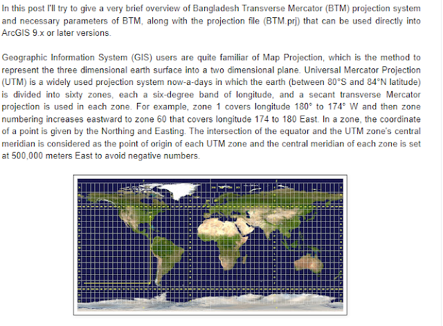
Bangladesh Transverse Mercator (BTM) A projected coordinate system has a flat, 2D surface with constant lengths, angles, and areas across the two dimensions. Which makes it easier to calculate properties  like area, distance of a object in map. UTM (Universal Transverse Mercator) is a widely used projected coordinate system which divides the Earth into sixty zones, each in six-degree interval. As Bangladesh lies between UTM Zone 45N and 46N, FAP19 has adopted a Transverse Mercator projection for Bangladesh. Parameter of this projection are NAME BANGLADESH TRANSVERSE MERCATOR (BTM) Projection Transverse_Mercator False_Easting 500000 False_Northing -2000000 Central_Meridian 90 Scale_Factor 0.9996 Latitude_Of_Origin 0 Linear Unit Meter (1.0) Geographic Coordinate System GCS_Everest_1830 Angular Unit Degree (0.0174532925199433) Prime Meridian Greenwich (0.0) Datum D_Everest_1830 Spheroid Everest_1830 Semimajor Axis 6377299.36 Semiminor Axis 6356098.352 Inverse Flattening 300.8017 Please no

GIS Mapping / Four (4) Main Ideas of GIS Mapping

Image
GIS Mapping GIS mapping produces visualizations of geospatial information. The 4 main ideas of Geographic Information Systems (GIS) are: Creating GIS data or geographic data Database Creation and management of geo-spatial data Analysis of GIS data Presentation or visualization of analyzed data Because viewing and analyzing data on maps impacts our understanding of data, we can make better decisions using GIS. It helps us understand  what  is  where . The analysis becomes simple. Answers become clear. Source: https://gisgeography.com/