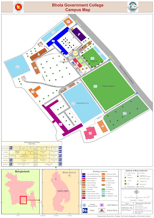
How to Prepare Campus Map or Any Institutional Location Map using ArcGIS and with a little help of Graphics

Locator map of Bhola Govt. College Suddenly, My boss asked me to Prepare a campus map. At first, I thought it was easy but not that much. This is not the final file. If you want to know and get the guidelines then contact with me. Oh !! It took surprisingly less time than expected. ই ক্যাম্পাস ম্যাপ বা প্রতিষ্ঠানের অবস্থান ম্যাপ তৈরি করা ArcGIS ব্যবহার করে, যা গ্রাফিক ডিজাইন উপাদানের সাথে যোগ করে তবে ব্যবহারকারীদের জন্য সামগ্রিক নেভিগেশনাল অভিজ্ঞতা অত্যন্ত উন্নত করতে পারে। একটি শক্তিশালী ভৌগোলিক তথ্য সিস্টেম (GIS) সফটওয়্যার, ArcGIS স্থানীয় তথ্যের সংযোজনের অনুমতি দেয়, এটি বিভিন্ন ক্যাম্পাস বৈশিষ্ট্যগুলি ম্যাপ করার জন্য একটি আদর্শ সরঞ্জাম। Begin the process by gathering relevant spatial data, such as building outlines, walkways, parking lots, and landmarks. This information can be collected through satellite imagery or surveyed using GPS devices. Import the data into ArcGIS, ensuring accurate georeferencing for precise spatial representation. এই প্রক্রিয়া শুরু করুন যার মাধ্যমে ...