Population Density of Bangladesh with Spatial Density Map
Population density of Bangladesh
Population density is a measurement of the number of people in an area. It is an average number. Population density is calculated by dividing the number of people by area. Population density is usually shown as the number of people per square kilometer.
Bangladesh has the highest population density among large countries, 1,237.51 persons per square kilometer, and 12th overall, when small countries and city-states are included (Source: CIA world Fact Book: 2012)
Sustained population growth has pushed the population density from 290 to 1237 people per square kilometer between 1950 and 2012. Population tripled during this period from 42 million to 149 million. Bangladesh's high population density is prevalent across the nation except in the mountainous Hill Tracts in the Southeast, the Sundarbans mangrove forests in the Southwest, and to a lesser degree the Sylhet area in the Northeast corner.
Due to huge population size, the density of population is already five times that of any other ‘mega’ country (>100 million), a very challenging situation for an agricultural society. Most of the future growth will be urban, increasingly in slums. Numbers of young people will not increase, but numbers of older people will increase 10-fold this century, creating a large burden on the health system, especially for chronic illnesses. High density of population means that agricultural land is virtually saturated, with very limited capacity to expand food production.
The map below is a choropleth (shading) map and illustrates population density of Bangladesh as District wise. The darker the color, the greater the population density.
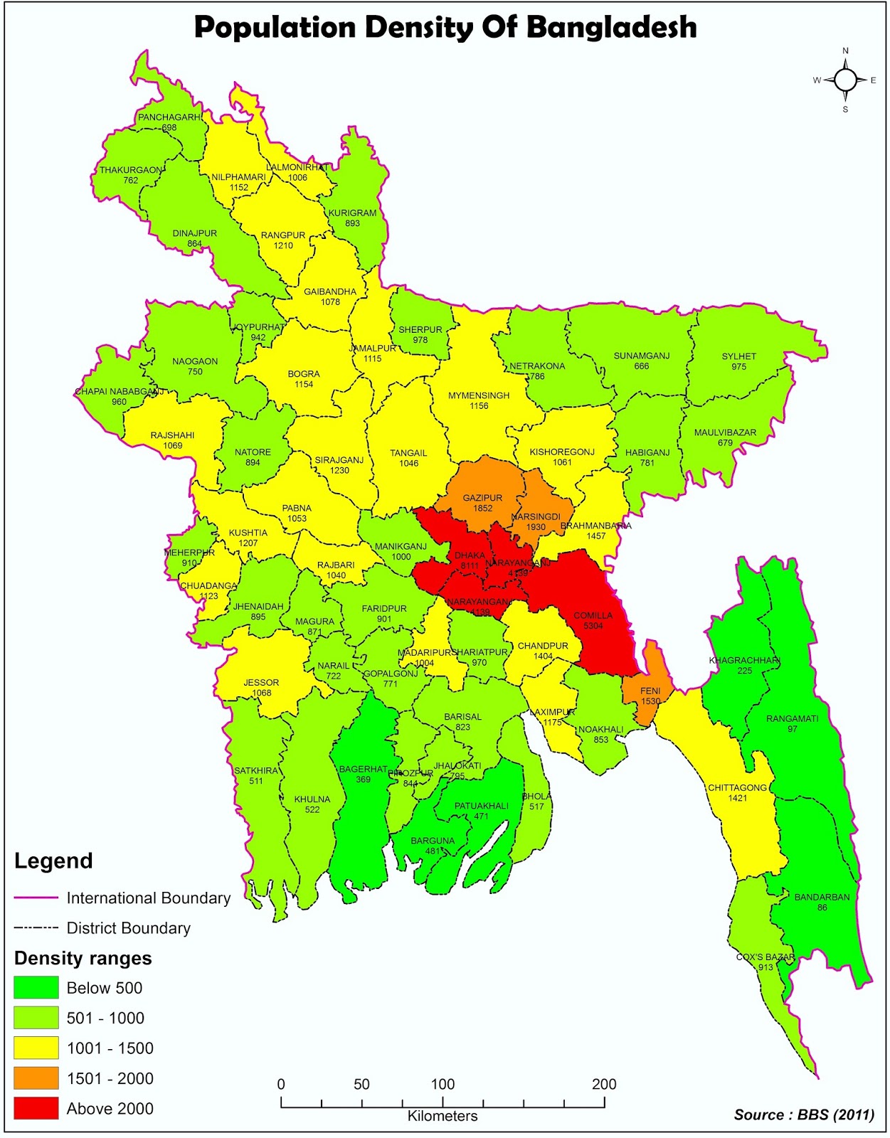 |
| Map : Population Density of Bangladesh (District-Wise) |

Comments
Post a Comment